to create a vibrant network of connected open spaces between the Merrimack Valley and Mystic River watershed into Boston.

Area Maps

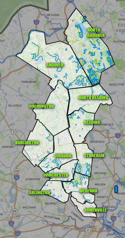
Here is an initial map of planned routes. This will change over time as the project progresses.

This composite map  on the left shows many of the towns in the Mystic Link Alliance area shows the concentration of trails in some communities and almost total lack of trails in others.

This Google map  on the right shows roughly the same area as the map on the left.

Holt Hill to Stoneham, November 2023

Here is a Google map of the current working version of a section of the Mystic Link trail.

It includes two sections with alternate options.

Keep in mind that many spur trails can be added to link to conservation areas to the east and west of the main trail.